A Carian city near Yatağan whose ruins are reached along Ottoman paving stones past inhabited village houses: the largest gymnasium known from antiquity and a calendar carved in stone.
Stratonikeia is an ancient city located in Turkey, Mugla. Main periods: Archaic Period, Classical Period, Hellenistic Period, Roman Period, Byzantine Period, Ottoman Period, Bronze Age, Beyliks Period.
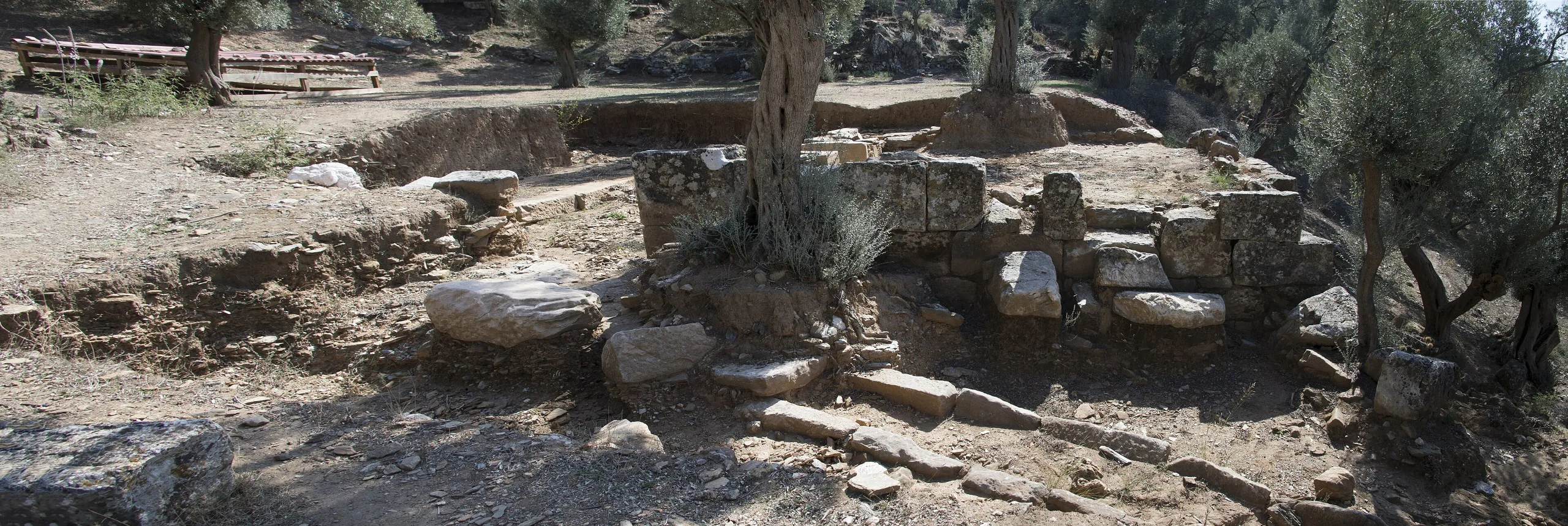
At Stratonikeia you reach the marble buildings of a Hellenistic city by walking over Ottoman paving stones. This Carian town lies inside the village of Eskihisar in Yatağan district, Muğla, and its ancient monuments, Byzantine and Beylik-period remains, Ottoman landlords' houses and shops of the early Republic all share a single street fabric. Few places let you read Archaic, Classical, Hellenistic, Roman, Byzantine, Beylik, Ottoman and Republican layers in one walk.
Location and access
The city stands about 6-7 km west of Yatağan on the Yatağan-Milas road, at the foot of Kadıkule Hill on the western edge of the fertile Yatağan plain. That spot, where main routes linking western, central and southern Anatolia cross, helps explain how long the settlement lasted. Visitors reach the site from the Muğla-Bodrum road by going about 1 km inland from Eskihisar. For current visiting details, check the official page.
History
People have lived here without a break since the Late Bronze Age, around 1500 BCE, and the earliest finds from the city centre date to the end of the 2nd millennium BCE. The place was called Atriya in Hittite times and Khrysaoris or Idrias in the Classical period, the settlement that Herodotus, Strabo, Pausanias and Stephanus of Byzantium mention. It became a city proper in the early 3rd century BCE, when the Seleucid king Antiochus I (281-261 BCE) refounded it in the name of Stratonike, first his stepmother and then his wife. Strabo describes it as richly furnished with fine buildings.
Control passed between Ptolemies, Macedonians and Rhodians until the city won independence from Rhodes in 167 BCE and began to strike its own coins; the coins turned up in excavation run on to the reign of Gallienus (253-268 CE). Rome absorbed the region in 130/129 BCE. Building boomed in the Early Empire and above all in the 2nd century CE, and the city stayed a regional centre until Late Roman times.
From Early Byzantine times the population fell, and in the Middle Byzantine period the town shrank further. Turkic tribes reached the area at the end of the 11th century, and life carried on through the 14th-15th century Beylik period and beyond. Under Ottoman rule the settlement gained many fine buildings, and from the late Ottoman years into the Republic the houses of local landlords gave the village its look. The earthquake of 1957 pushed the village to a new site, yet four families still live in old houses inside the ancient city.
Plan and walls
A fortification wall about 3600 m long traces the city limits and makes its size easy to judge; two separate circuits survive, one Archaic and one Classical. The Hellenistic city followed a Hippodamian plan, meaning a grid of streets crossing at right angles, and Roman builders kept it. Earthquakes repeatedly brought buildings down, and each time the city was rebuilt with a sophisticated water and drainage system. Digging has so far touched only some buildings, so the plan still shows just a fraction of what stood.
Notable structures
North Gate and colonnaded street
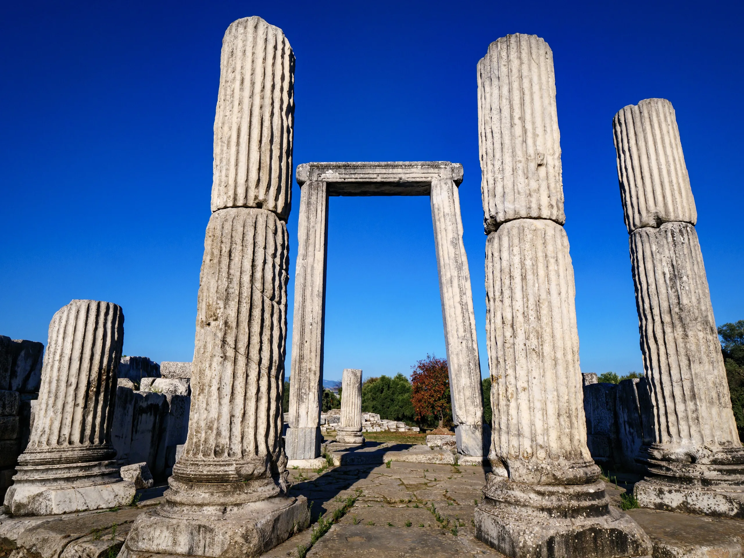
The sacred road from the sanctuary of Hekate at Lagina enters the city through this gate in the northern wall, so it served as both entrance and ritual setting. It was probably built between the late Antonine and early Severan periods. Monumental arched doorways flank it; between the two that face the city stands a fountain with semicircular pools, statues and two storeys of Corinthian columns. In front lies an open space 42 m wide ringed by eight Corinthian columns, and from its southern middle the 8.70 m wide colonnaded North Street heads for the centre.
Gymnasium
Just southwest of the North Gate, the gymnasium went up in the second quarter of the 2nd century BCE. Its narrow front measures 105 m and its estimated length is 267 m, making it the largest known from the ancient world. A Greek gymnasium was a sports ground and a school in one, and lessons in history and philosophy were given here.
Bouleuterion and its two inscriptions
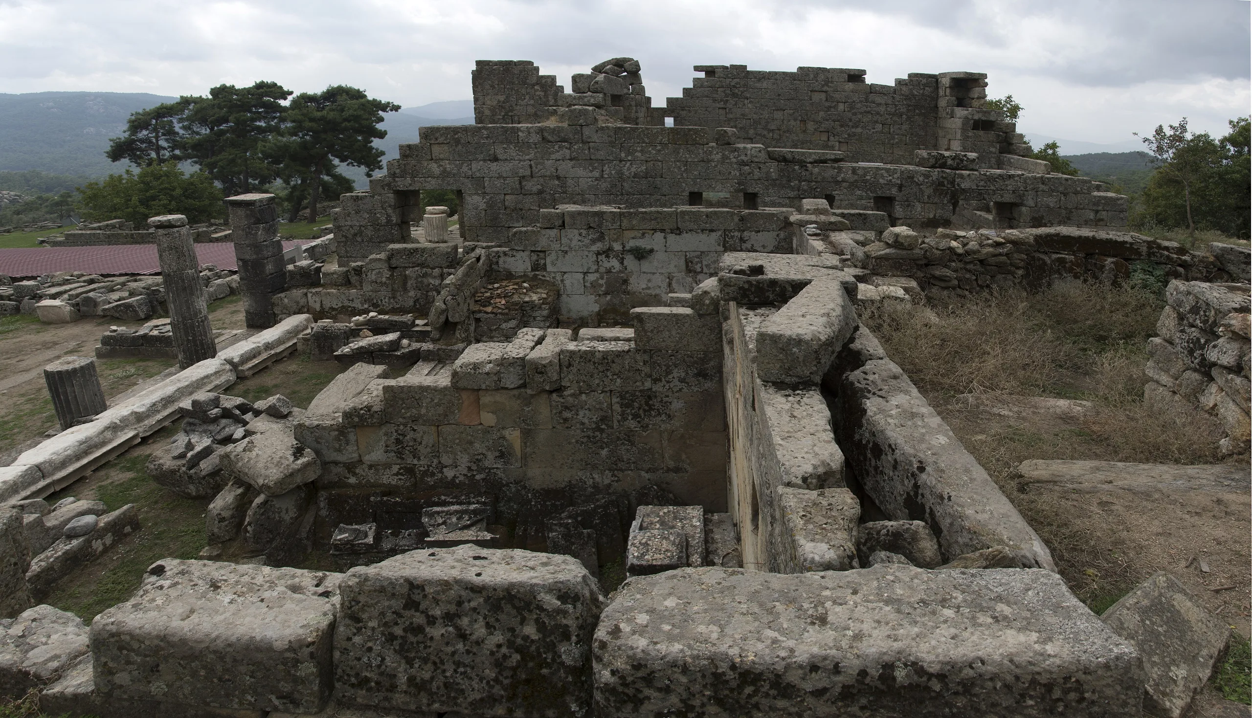
The bouleuterion, or council house, sits in the middle of the city. Its rectangular plan runs east-west, and its architectural details place it in the later 1st century BCE. Two rare inscriptions cover the faces of its north anta wall, the side wall that frames the entrance. Inside is a Greek calendar from the early 1st century BCE made by Menippos, a native of Stratonikeia whom Cicero counted among the finest orators of his day; it lists 12 months with their day counts for the year 1505, which marks the city's foundation. Outside is a Latin price list of 301 CE for goods and services sold in Roman times, the finest surviving price edict in Asia Minor, and unique in being cut into a council-house wall. Flower ornaments and inscriptions of Ottoman date can also be seen on the south wall.
Theatre, temple and baths
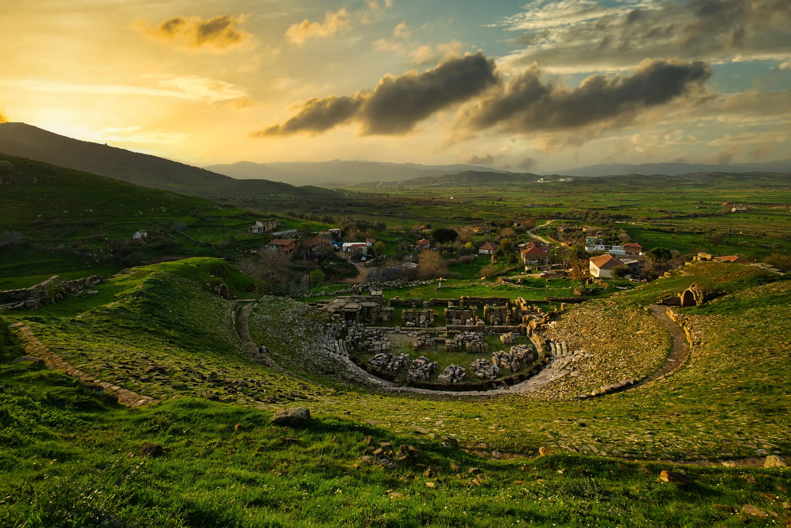
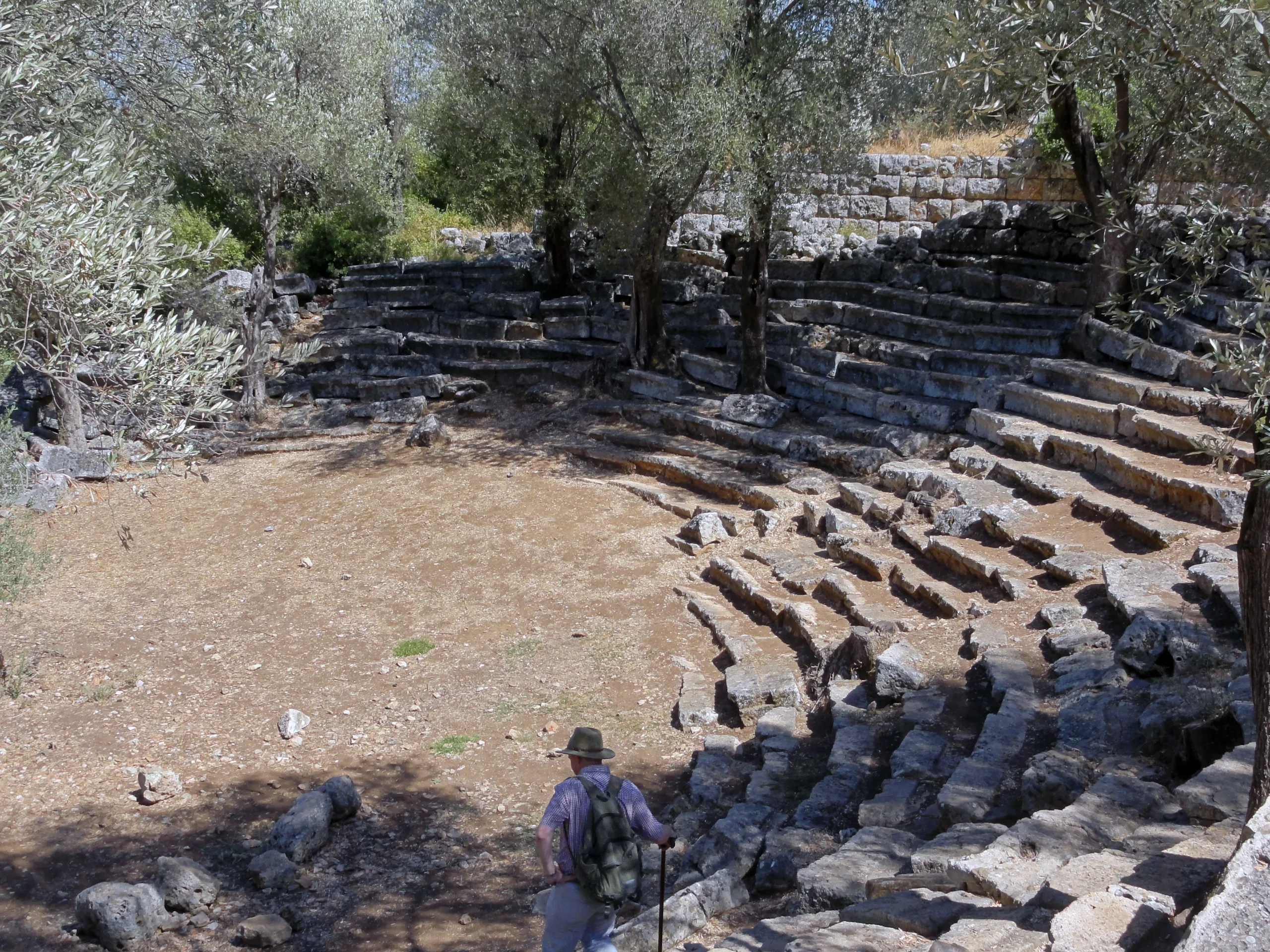
The Greco-Roman theatre rests on the natural slope of Kadıkule Hill and is estimated from its remains to have held about 12,000 people. On a terrace above it stands the Ionic peripteral Augustus-Imperial Temple, which looks as though it was designed together with the theatre. Roman Bath 1, built in the 2nd century CE, is one of three baths known from inscriptions; its symmetrical north-south plan follows Carian tradition, with undressing, cold and warm rooms and at least six service rooms.
Eskihisar village square
West of the ancient centre, about 50 m east of the western wall, lies the old village square. A Turkish bath of the 14th-15th centuries, the Şaban Ağa Mosque of 1876, ten coffeehouses, five butchers, two bakeries, two tailors and twenty assorted shops form a market that runs from the Beylik age into the Republic, shaded by plane trees over 200 years old. Ottoman stone roads and pavements are well preserved and slope to the sides or the middle to drain rainwater. Ancient marble blocks were reused in the walls of many village houses; the best examples are the Abdullah and Hadi Eskişar house of 1876 and the Mehmet Eskişar house of 1909. The Hasan Şar House (1940), built of rubble, ancient marble fragments and brick, served as the excavation house until 1999 and is now a museum store.
Sacred places and legend
Stratonikeia is the only known city-state with two great sanctuaries, one to Zeus and one to Hekate, goddess of magic, the moon and ghosts. A key-carrying ritual involved a walk of about 9 km from Lagina, and a statue of Zeus was carried between Stratonikeia and Panamara. The city has long been called the city of eternal love and of gladiators, since gladiators are said to have trained, performed and retired here.
Excavation and protection
Scientific excavation began in 1977 under Yusuf Boysal, and since 2008 Bilal Söğüt has directed research, digging and restoration, with the aim of conserving the ancient city and the old village of Eskihisar as one whole. The area was registered as an archaeological site in 1982, is monitored regularly, and the excavated monuments belong to a conservation programme. Türkiye placed Stratonikeia on the UNESCO World Heritage Tentative List on 13 April 2015. Coastal cities such as Ephesus, Miletus and Caunus were abandoned as their surroundings silted up; Stratonikeia, inland, never was, which is why its ruins can be toured on Ottoman streets.
Frequently asked questions
Where is Stratonikeia?
Who gave the city its name?
Can you see an Ottoman village among the ruins?
What is the largest building?
What is the Menippos calendar?
Is Stratonikeia a UNESCO World Heritage Site?
Sources (4)
- Stratonikeia Örenyeri / Stratonikeia Archaeological Site (TR ve EN sayfalar) — T.C. Kültür ve Turizm Bakanlığı, Müzeler ve Ören Yerleri
- Stratonikeia Antik Kenti - Muğla (kaynak: Muğla İl Kültür ve Turizm Müdürlüğü; KVMGM) — T.C. Kültür ve Turizm Bakanlığı, Türkiye Kültür Portalı
- Ancient City of Stratonikeia (Tentative List ref. 6041) — UNESCO World Heritage Centre
- Stratonikeia (Pleiades place 599947) — Pleiades